What is GeoServer?
GeoServer is an open-source tool that allows anyone who wishes to obtain data streams from the source database. The service securely links data storage to spatial projects in software such as QGIS or ArcGIS.
Data retrieval protocol
The data streams made available to users are WMS and WFS, as recommended by the European Union under the INSPIRE standard. The WMS service is an implementation of the OGC WMTS Web Map Tile Service 1.0.0 standard. In addition to the WMS version, we also provide another data exchange protocol to meet all user needs:
| WMS | WFS | |
|---|---|---|
| Data type | Pixelated data (Raster) Information is downloaded by tiles |
Vectorized data (Vector) Information is downloaded in full |
| Style | The data has a default style applied | The data has no formatting |
| Download | ❌ | ✅ |
Using data in QGIS
All data streams made available require no authentication from users.
WMS
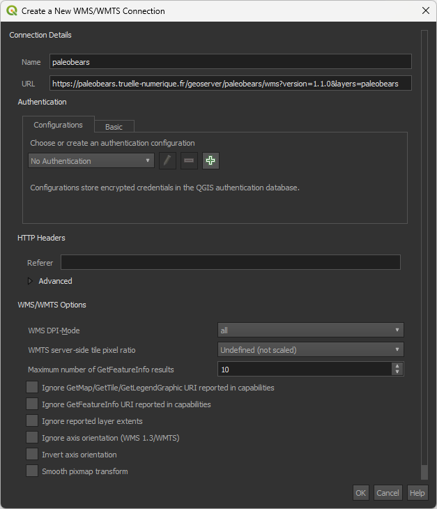
The entire catalog is accessible at the following address: https://paleobears.truelle-numerique.fr/geoserver/paleobears/wms?version=1.1.0&layers=paleobears.
Tip
The catalog includes a wide variety of data layers. These layers can be filtered using CQL. The filter syntax is documented on the official GeoServer website.
To add the entire WMS catalog, simply add the Paleobears server to the WMS data sources:
WFS
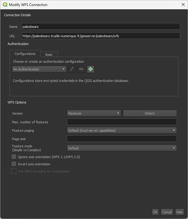
The entire catalog is accessible at the following address: https://paleobears.truelle-numerique.fr/geoserver/paleobears/wfs
To add the entire WFS catalog, simply add the Paleobears server to the WFS data sources: