What is GeoNetwork?
GeoNetwork is an open-source service for publishing data. The service allows each data layer to have its own record.
The GeoNetwork service is available at paleobears.truelle-numerique.fr/geonetwork.
GeoNetwork also makes it possible to manage page translations and multilingual display, as well as the origin of the data. Traceability.
Data records
Creating data records makes it possible to attach metadata to source data. All records comply with the European INSPIRE directive.
Record header
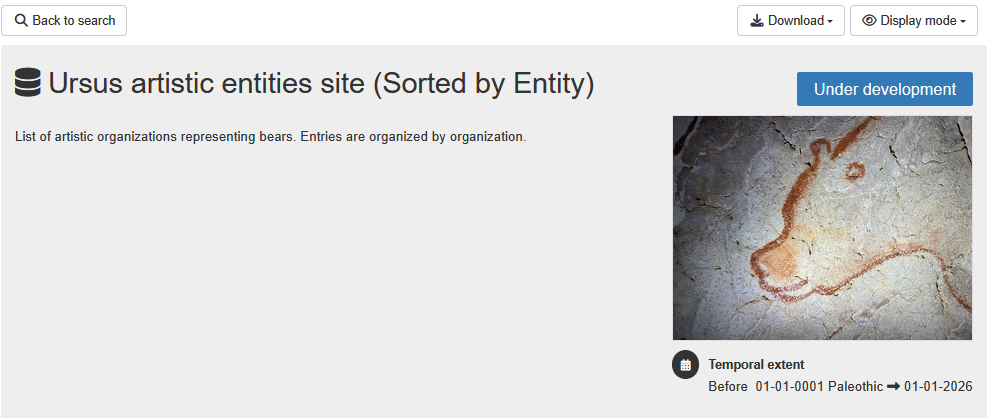
The records display a summary of the resource type and the status of the data, depending on its update frequency.
Warning
Due to technical limitations of the records, dates and temporal extents cannot be earlier than 01-01-0001. In that case, the period is specified.
To share the resource or archive it, it is possible to download the record in PDF format.
Data preview
Tip
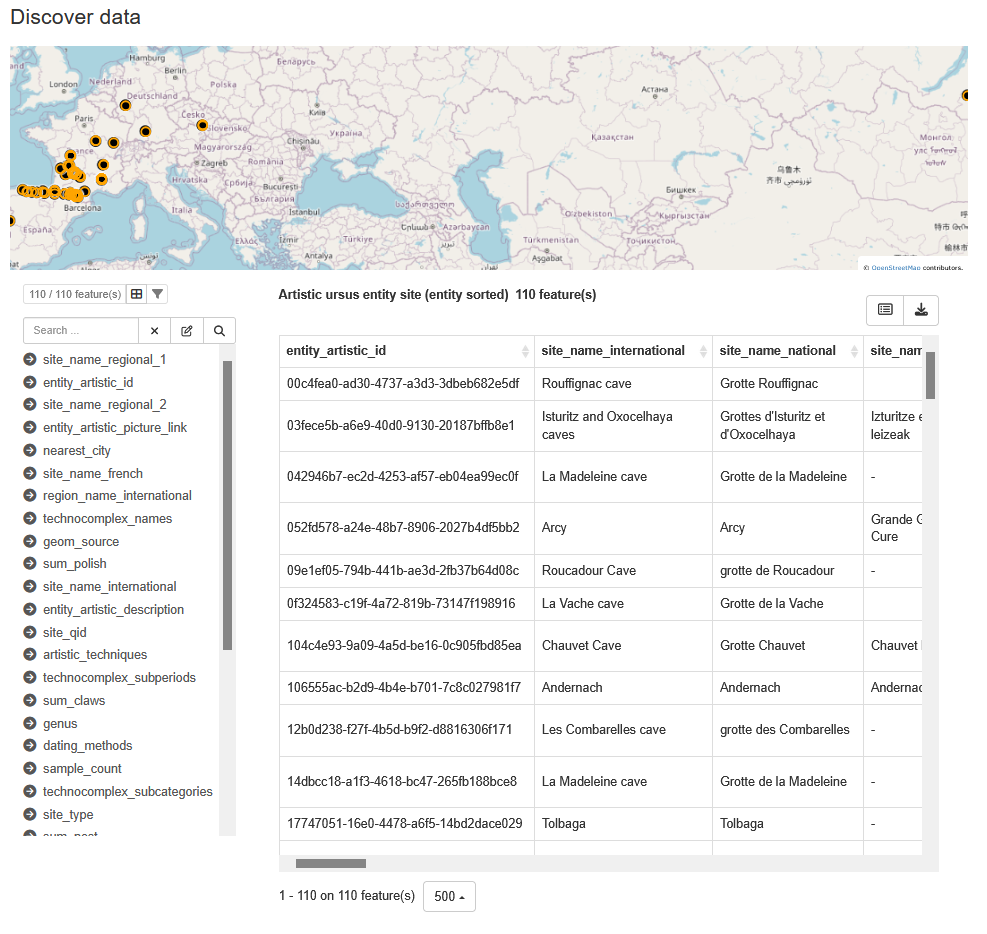
This section concerns only spatial data. Data without coordinates cannot appear on the map.
For each record, when the data are spatially referenced, a map shows the distribution of all entities. This map is only a preview; it is not possible to perform more complex actions such as reprojections or measurements.
All attributes are listed and can be consulted or modified in preparation for downloading the data. All modifications are made locally and do not affect the source database.
The data can be previewed in tabular form. They can also be downloaded in CSV format quickly.
List of available services
Info
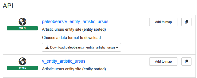
For the Paleobears project, all viewable data can be downloaded through WFS.
In this section, all data visualization and download services are grouped together. These services vary depending on the data uploaded. Most data can be used through the OGC WMS/WFS standards.
For each data source, it is possible to view it more fully on a map by clicking Add to map. The map view allows for quick measurements and the creation of rapid cartographic outputs without additional spatial software.
Metadata list
Tip
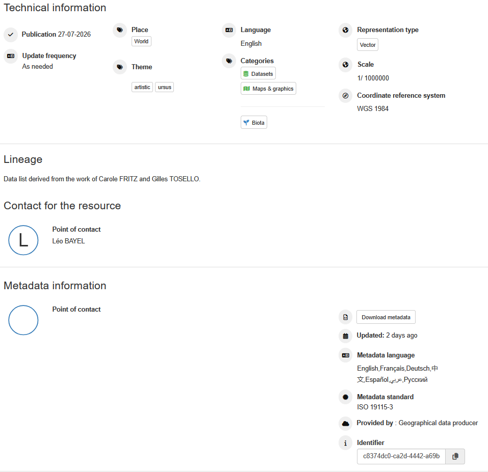
All metadata can be downloaded at the bottom of the record.
All metadata needed to describe the data is available in this section. This is where the spatial system CRS is specified. By default, all spatial data are in WGS84.
It is possible to copy the resource link to add it to QGIS or any other online cartographic service.
For each record, at least one contact point is present, in addition to the email address of the data author.
Info
For the technical part, the reference contact is leo.bayel[at]cnrs.fr
Data portals
Tip
To facilitate information retrieval, thematic portals help ensure that data are correctly structured according to the need. These portals therefore act as filters across the available records.
All data are available in the Paleobears catalog, while two portals provide access to data filtered by theme.
- Paleobears data catalog:
https://paleobears.truelle-numerique.fr/geonetwork/srv/eng/catalog.search#/home - Thematic portal on bears:
https://paleobears.truelle-numerique.fr/geonetwork/paleobears/eng/catalog.search#/home - Thematic portal covering all species present in the database:
https://paleobears.truelle-numerique.fr/geonetwork/paleonimal/eng/catalog.search#/home